Showing posts with label fishtug. Show all posts

Monday, 24 November 2014

Up The River, But Not Up The Creek, Part One


"...in the face of a hurricane west wind..."
                                  -Gordon Lightfoot


  This time last week, the temperature was below freezing, and the first snow of the season was flying.

   Today, the snow is gone and the temp is positively balmy, but we are getting slammed by a meteorological freight train that hasn't slowed down since it left Kansas.  Steady 40-50 knot winds hurt your face.

   Here's how the Lake looked this afternoon:


     Steady 40-50 knot winds hurt your face.


   So, I figured this a good time to revisit a more placid day in Port Dover.

   It's mid-September, and the weather is well and truly balmy,  not too hot, not too cold, not too humid, not too dry, a little underwindy, but oh, well... one of those late summer/early fall days that are too good and too rare to waste.

   SWMBO and I decided to put it to use by making a Quack run up the River, seeing what we could see.

  Th is is hardly the Canadian equivalent of a Joseph Conrad/ Coppolian saga- the Lynn River is the tributary that inconveniently divides Port Dover...

                                                                                         -image courtesy of portdoverwaterfront.com

..... it is also the source of some small controversy.  As you can see on the map above, the Lynn flows from Northwest to South, through the town of Simcoe, then into the town of Port Dover, where it meets Black Creek, flowing Northeast to South, and then discharges into Long Point Bay.

      The controversy arises below the Y- is the waterway south of the confluence the  Lynn River, or Black Creek?  Some refer to this stretch as "the creek", others as "the river", others, noting that aforementioned body of water has been dredged, widened, straightened and breakwalled, refer to it as "the channel."

       Personally, I figure a creek can flow into a river, yet a river cannot flow into a creek, just as a town can grow into a city, but a city cannot grow into a town...ergo, it is the Lynn River which empties into the Bay, not the Black Creek.

      (Not that anybody really gives a shit. -ed.)

      Er, anywater, we had been up the River and up the Creek dozens of times, always aboard the mothership, but had never turned left and taken the Lynn less travelled, as it were.  Concerns over the uncertainty of draft, airdraft and general  there-are-never-any-sailboats-there-so-sailboats-must-not-be-able-to-go-there logic led us to mark the upper Lower Lynn with "here there be dragons" on our mental chart.

     But, not wishing to leave any local waters unexplored,  we decided to take an hour or so and make a Quack attack.

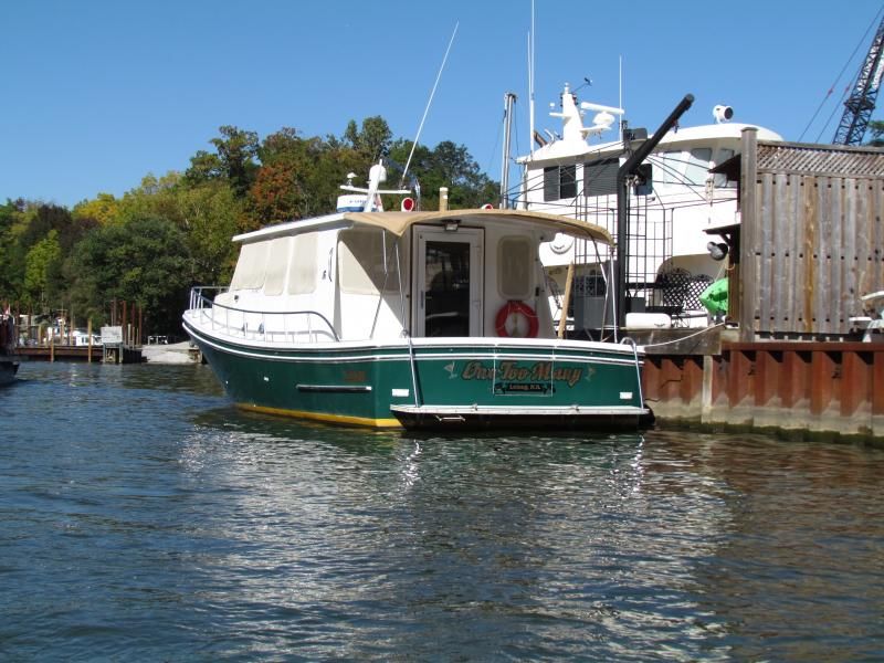
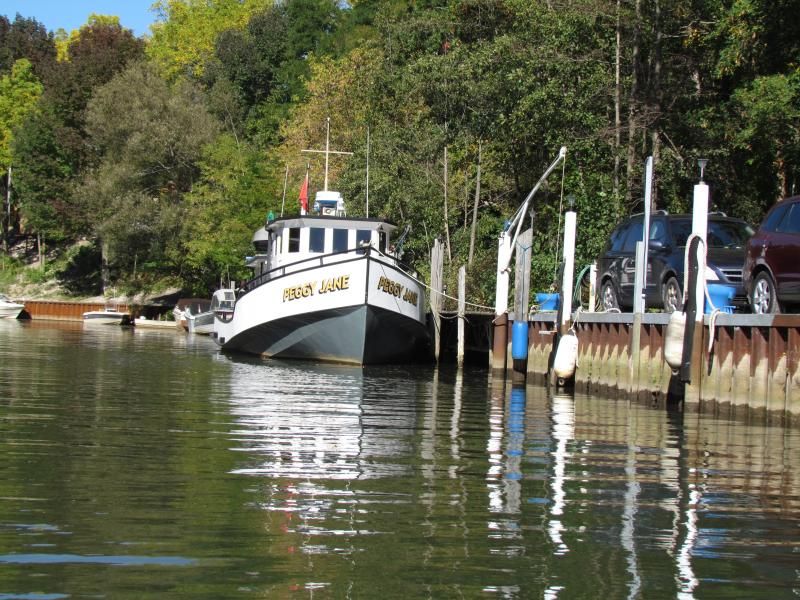
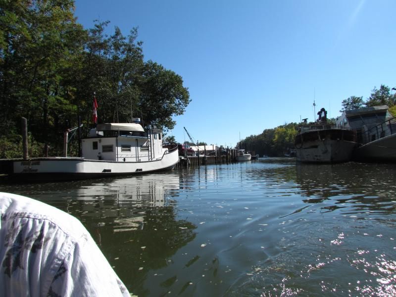
    We tied up NextBoat opposite the old Misener fish plant, clambered into Quack, our 7 foot long inflatable, cranked up our trusty Suzuki O/B, bid our floating condo adieu...


...and headed upstream.

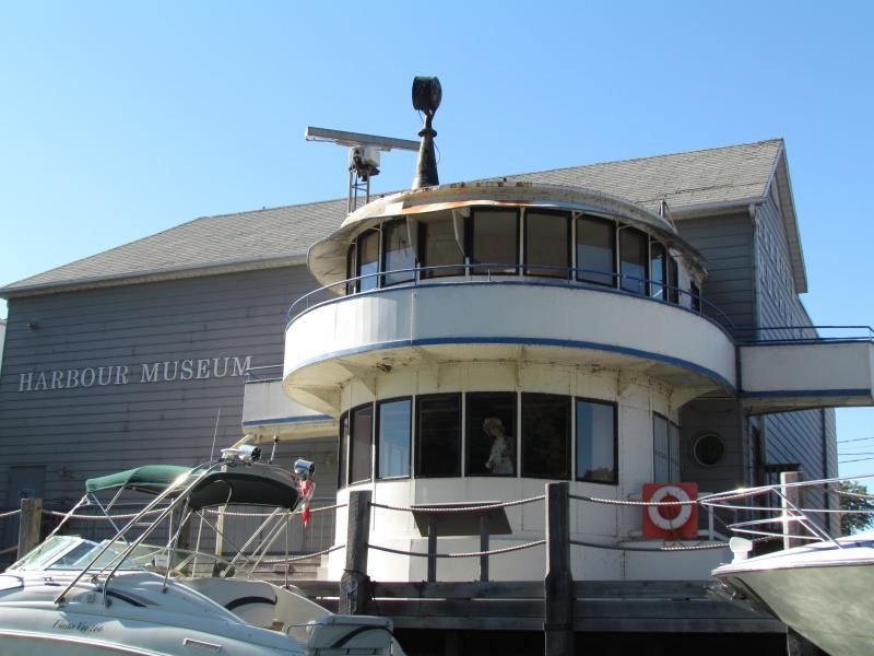
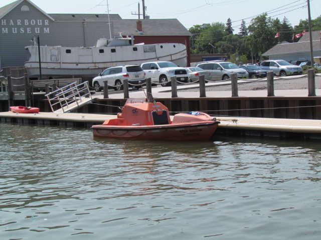
   We putted past the Port Dover Harbour Museum...


  ... past the new dinghy dock, snapping pics of the intriguing boat tied up...


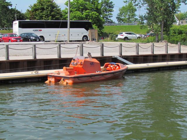
lifeboat/tender/pilot boat from a freighter?


 ( Please comment if you have any info.)


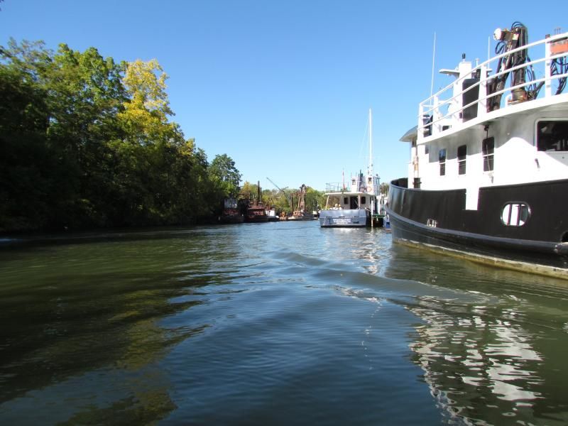
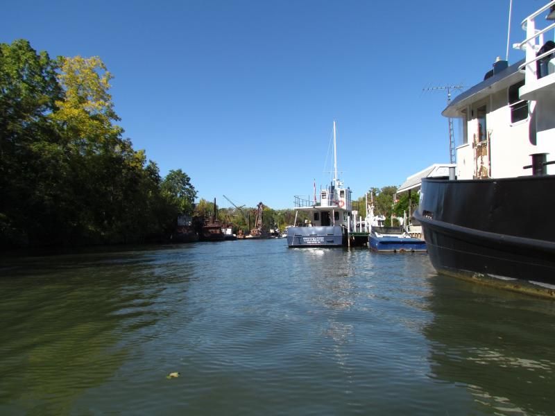
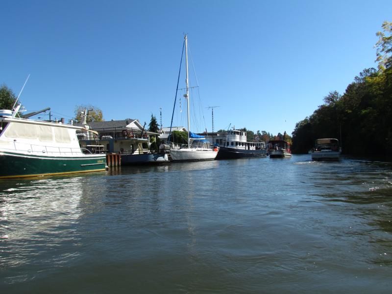
     ...then under the lift bridge and past the Scruton fleet...


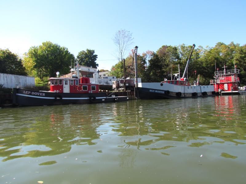
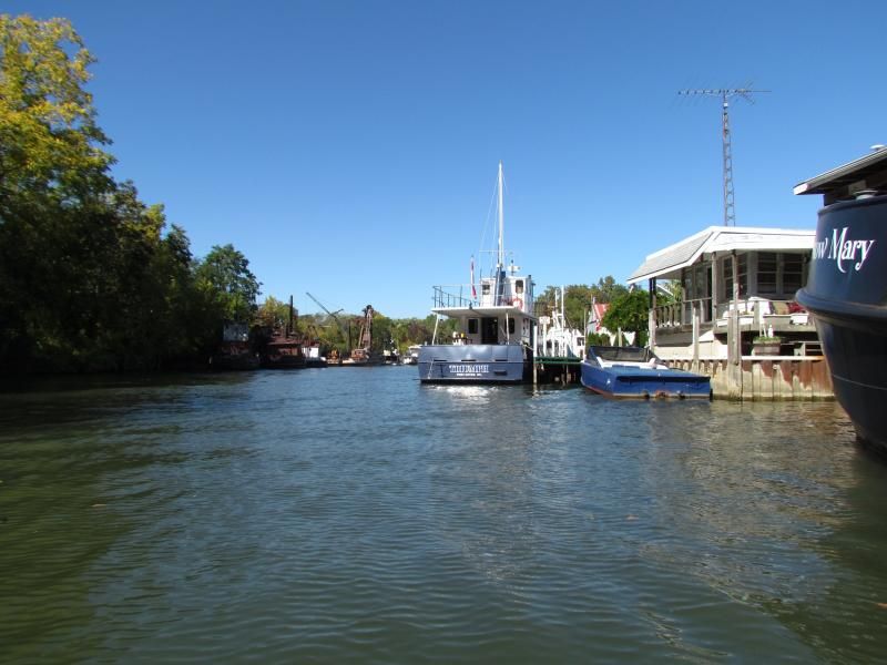
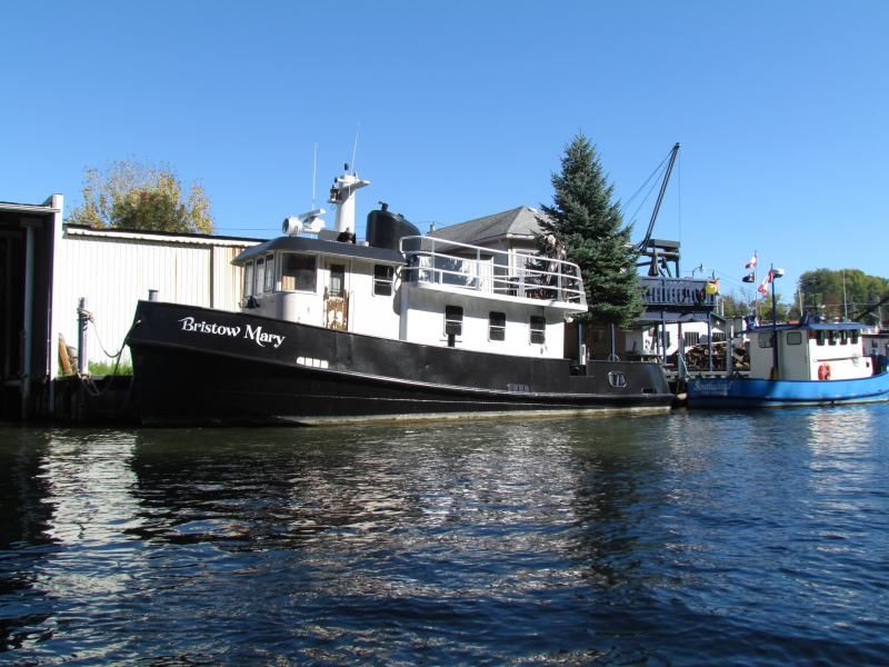
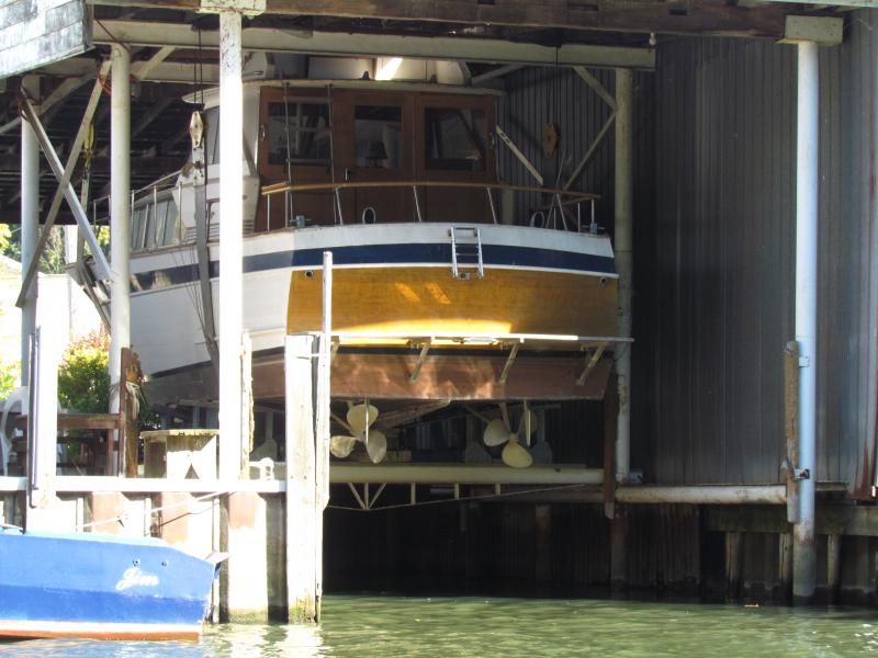
... then past the Bridge Yachts yard, and then past Dave Matthews yard,  into the heart of tug town...


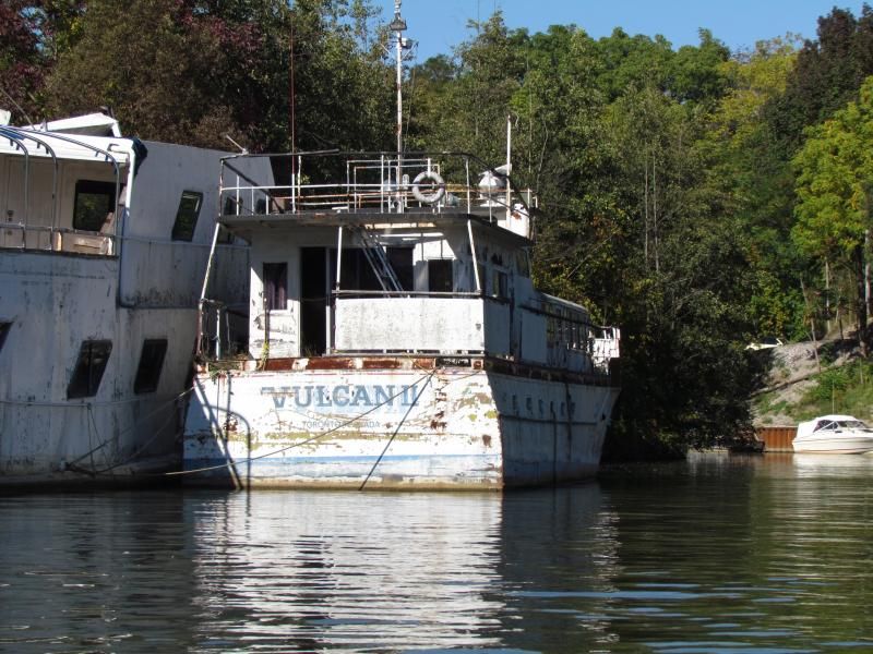
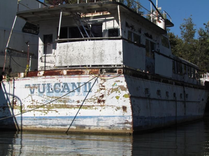
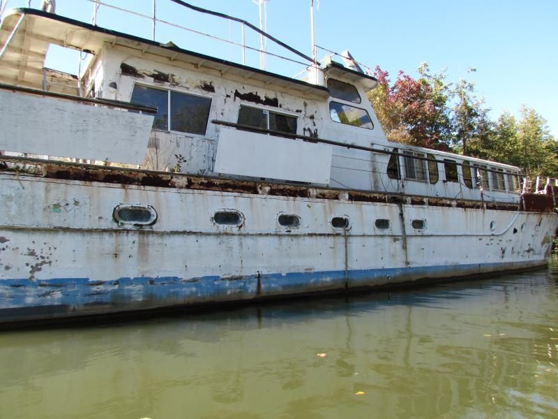
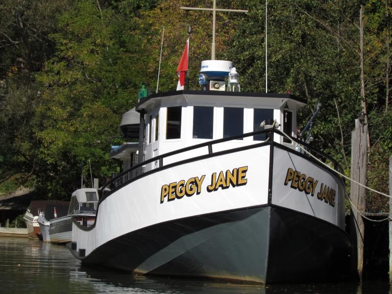
   I admit, I am a sucker for tugs...


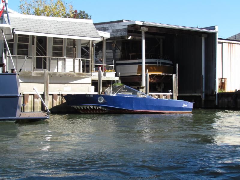
    and who doesn't like a beautiful woody?


  ...  get your minds out of the gutter.


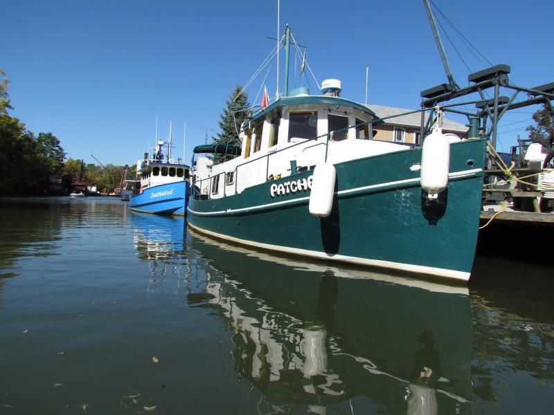
   We pass the Nadro Marine yard...


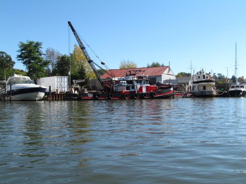
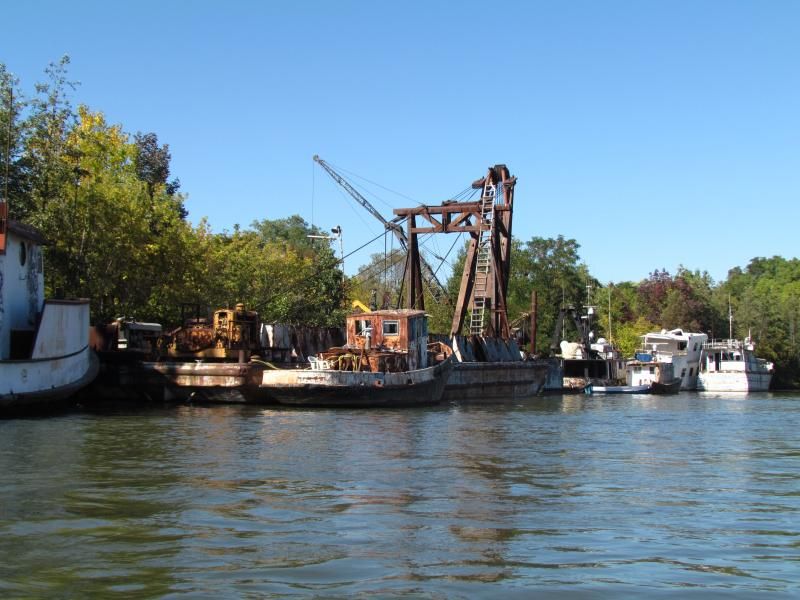
... bear to port and head up the Lynn, into the elephant's graveyard of the Harry Gamble shipyard.


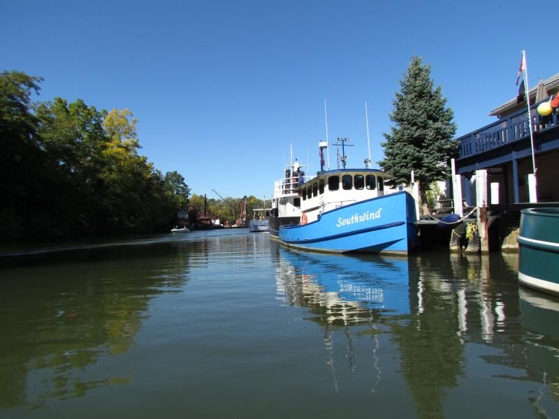
  Meanwhile, to starboard...


The juxtaposition between banks is almost jarring.


   and back to our port side...


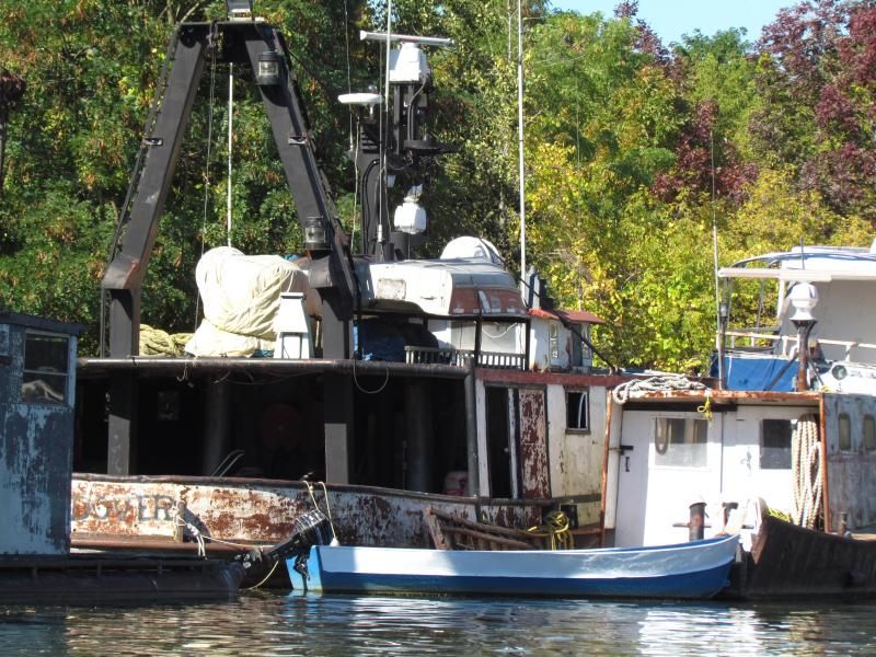
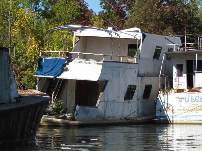
 and then things start to get ...interesting.


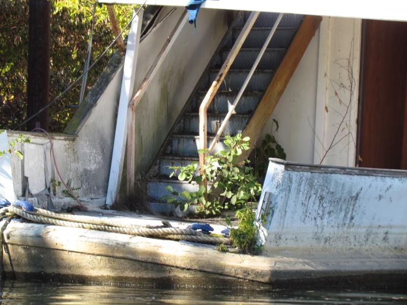
     The Gamble yard is acres of old tugs, barges, lifeboats, pleasure craft, engines, winches and rust, covered with an increasingly impenetrable cover of foliage.


      It's intriguing as hell.

We spotted this inlet....


...before we noticed the cottage beside it


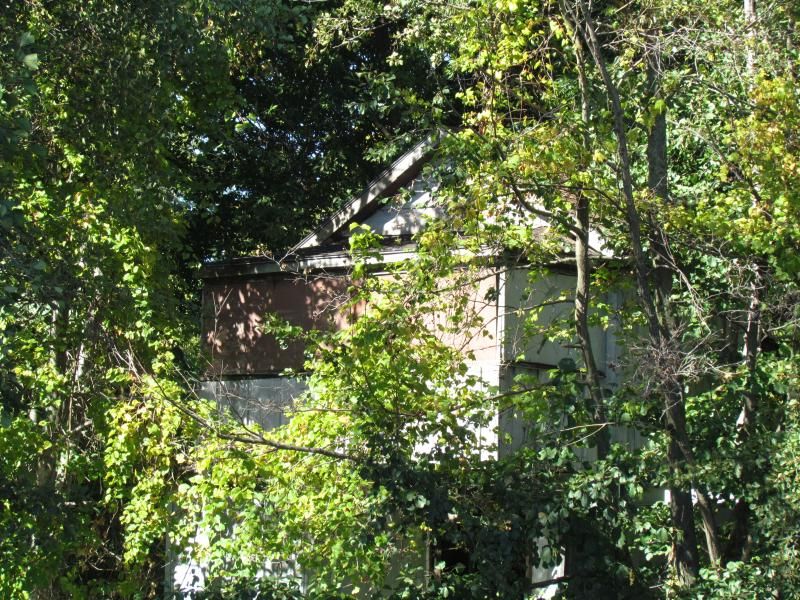
Of course we had to steer in, to see what we could see...


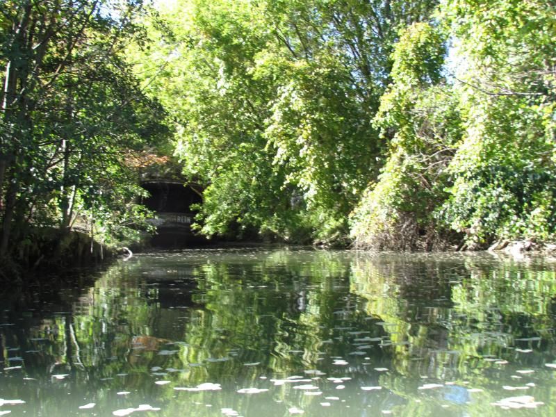
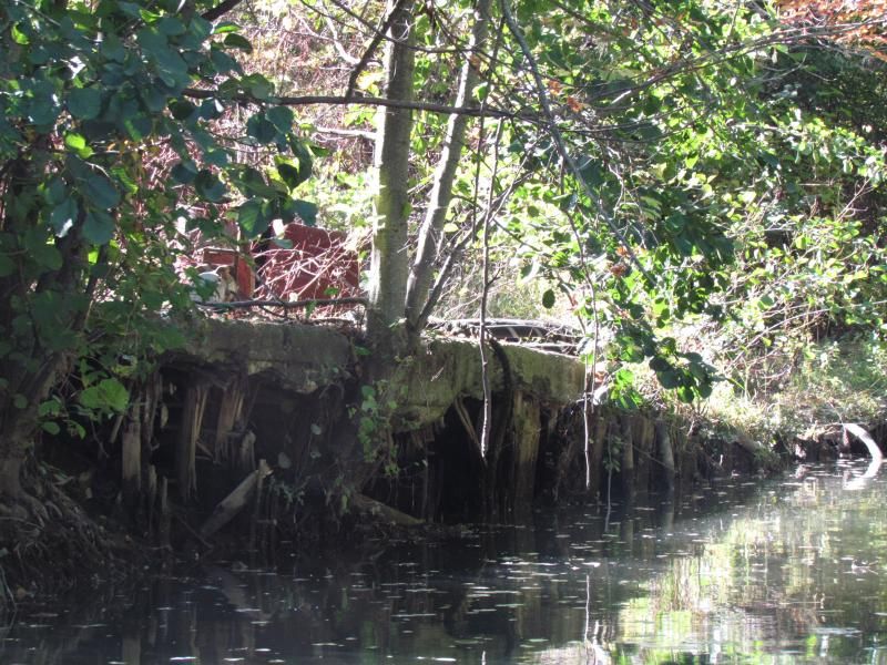
      As our outboard began to bounce along the bottom, I realized how silted up this basin had become.  That tug  is never leaving again.


      We retreated back to the Lynn and continued upstream.


  More to come later this week.


  Meanwhile,

"Talk the Dock!"


Sunday, 8 September 2013

A Blast from the Past on The Bay

       "And it's a fair wind, blowin' warm...."
                           Crosby, Stills and Nash

         This summer has been a bit of a bust, weather-wise, down here on the Dock.  Either cold and wet, or hot and humid, no wind or too much wind, often all on the same day.

        The Labour Day weekend was no exception.

         Thanks to some strategic vacation day planning, SWMBO and I extended our Labour Day weekend through to Wednesday.

        We were glad we did.

         Friday was overcast, but that didn't stop Mark and Kathy from taking their Corvette, Meisje, out for a sail.   The Dock's short fingers didn't prevent them from stopping in for a cocktail.  Yes, a 30 footer will fit on the Dock:

   More on this great example of a classic plastic design in an upcoming OPB post.

       Saturday and Sunday SWMBO and I were both engaged in gainful employment, leaving time for little besides breakfast research for an upcoming Behind The Beach post....  and watching boats heading out for the yacht club Christmas(?!?) Boat Parade.


       Monday, we both did nothing but enjoy the fact that we were not working.

       Tuesday was a lounge day- a day to get caught up on boat projects, curl up in the cockpit with a book and just enjoy the solitude of a near-deserted marina.

        Mid-afternoon, I climbed onto Whiskeyjack's cabin to get a picture of the overcast and our new skyline for...

     ... Yes,  you guessed it...

    .... An upcoming blog post .


        Panning south to see what I could see, contemplating whether to finish another chapter in my read or whether to give SWMBO a nudge, light up the chugger,  drop the docklines and get on the water, something low on the horizon caught my eye:


     I pushed the zoom, steadied myself against the mast, and got hit smack in the eyeballs by an image from another century:


      You don't see a whole lot of square rigged ships on Lake Erie any more.   Throughout the afternoon, the ghost ship drew closer, becoming less ghostly:


    You know that this is gonna require a closer look-see, don't you?  Besides, the house battery was getting low, thanks to heavy use and a couple of low-sunlight days hampering solar panel performance,  so a good hour- long run under power was needed.

      As we clear the Marina breakwall and round buoy ED6, I start snapping shots:


    I realize,
    a)  She's big.
    b)  Because she's  big, she is also farther out than she looks.
    c)  Our house battery is REALLY drawn down, and is apparently  really due for replacement.

        With chartplotter, VHF radio and depthfinder  all pulling power, the house battery was quickly depleted below half and dropping like a stone.
      Huh.
     "Okay,"  thinks I, " it doesn't affect the drivetrain, so it's non-critical, figure it out back at the Dock , but in the meantime we're gonna need running lights soon, so it might be a good idea to conserve the juice we've got.     Turn off fixed mount VHF, turn on handheld, kill chartplotter and depthsounder, and hey! now we're navigating out to a big ol' square-rigger just like big ol' square riggers used to, via compass and charts and Human Eyeball, Mk I."

    Yar-HARRRRR!!!

Self-image:


       Reality:


     As the sun started to set, our goal became clearer:


   Besides Hilary scooting about in his C&C, this was the only other boat within view:


    Just as the sun dropped below the horizon, we got our close-up...


 and could finally get a name:   Sørlandet

    Here's some sense of  Sorlandet's size, measured in Whiskeyjacks*.

    She is 9 Whiskeyjacks long.

    She is 1.25 Whiskeyjacks wide.

    Her bowsprit is a Whiskeyjack...  including davits.

   She displaces 50 Whiskeyjacks.

   Her draft is 5 times Whiskeyjack's 3.5' draft.

   She has 13.5 Whiskeyjacks  worth of sails- 27 flappy things in total.

   With 13 304 square feet of sail area, Sorlandet is rocking about 53 Whiskeyjacks  of canvas.

  *A Whiskeyjack = 23 feet.

    Yeah.  She's big.  We're not.

     (* IN your best Jeremy Clarkson voice*) In fact, Sorlandet  is the largest and oldest Tall Ship...

...  in the world.

    And, she is Norwegian.

      This fact excited half-Norwegian SWMBO, who emailed the details to her wholly Norwegian mother, thus enabling bestemor  to share in our serendipitous discovery.

     Sorlandet was on the way downLake, returning from the last stop on the Tall Ships Challenge which was commemorating the War of 1812 this year, with stops at various historic locations throughout the Great Lakes,  on both sides of the border.


        Wednesday, she remained anchored, providing for some beautiful photo ops,


and a great backdrop to the Wednesday evening race.

    Thursday, like a faint memory of better times,  she was gone.


     We were privileged to have seen her.


   "Talk the Dock!"